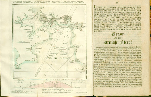
27. Map of Plymouth also showing cross-section of the Breakwater
Comments: A much simplified plan of the three towns but still
similar in some ways to the chart of 1817 with a plan of the breakwater below
it. Although dated 1819 the first examples
seen were included in a later work. Two copies found in editions of Interesting Particulars, relative to that
Great National Undertaking, the Breakwater, Plymouth Dock; J Johns:
Stonehouse; John Cooke. (1821). Note: some copies of this work have a different
map, Borough of Plymouth (see 25 above).
Below the bottom border is a Transverse section of the Breakwater and note on first stone being
laid in 1812 and two further lines of text referring to the Dartmoor Railway:
The first Rail was laid to the Plymouth & Dartmoor Rail Road by Sir Thomas
Tyrwhitt, Augt 12, 1819. Left of this is the imprint. Right of this is the signature.
Scale - Nautic Mile (1 = 23 mm). The directions on the breakwater sketch are face to the sea and the inside.
Devonport. W Colman. (1830.) BL, TQ.
[1] Note that some libraries catalogue this under Rennie and Whidbey as the text of their report is reprinted together with extracts from a government report of 1812. NLS 3.603(4): other libraries hold this work but only identify “maps”. The two maps were completed 1819 and 1820, but there is an Advertisement dated January 1821. The NLS and BL copies both have Cooke´s Borough map of Plymouth bound in.
[2] The cover title is Sanford´s Devonport & Plymouth Guide (publisher´s printed boards). The 1830 edition also included Cooke 20.3.


No comments:
Post a Comment