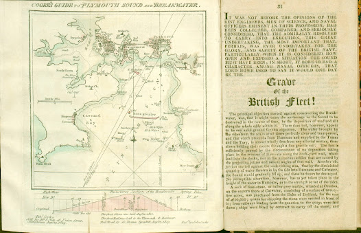
27. Map of Plymouth also showing cross-section of the Breakwater 27.1. Title: Cooke’s Guide To Plymouth Sound And Breakwater . Date: 1819 [1821]. Size: 150 x 140 mm inside border (185 mm total). Imprint(s): Pub d for & sold by M rs E Nile, 48, Union Street, Stonehouse, Aug 12, 1819. Signature(s): Eng d by John Cooke. Location(s): NLS, KB. [1] Comments: A much simplified plan of the three towns but still similar in some ways to the chart of 1817 with a plan of the breakwater below it. Although dated 1819 the first examples seen were included in a later work. Two copies found in editions of Interesting Particulars, relative to that Great National Undertaking, the Breakwater, Plymouth Dock; J Johns: Stonehouse; John Cooke. (1821). Note: some copies of this work have a different map, Borough of Plymouth (see 25 above). Below the bottom border is a Transverse section of the Breakwater and note on first stone being laid in 1812 and two further lines of tex...